
CSIRO and the Australian National Soil Information System (ANSIS) have launched a new online tool that turns complex soil data into clear visual information. The ANSIS Visualiser helps farmers, land managers, and researchers better understand soil health and manage it effectively.
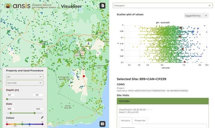
ANSIS collects soil data from across Australia and provides consistent national information. The new Visualiser shows differences in soil properties, such as pH and soil organic carbon, using simple colour maps. Users can see how measurements at one site compare with nearby sites. Graphs show changes in soil properties with depth.
CSIRO soil scientist Peter Wilson said the tool makes soil data easier to understand. “This tool gives people a clear view of the soil information they need to manage, restore, and protect Australia’s soils,” he said. “It can help users make better decisions for farms, ecosystems, and policy.”
The tool supports the National Soil Action Plan 2023–2028. The plan focuses on soil measurement, strategy integration, adoption of best practices, and building skills for soil management. Mr Wilson added, “Soil is the backbone of agriculture, biodiversity, and many ecosystem services. Caring for soil today ensures food and environmental security for the future.”
ANSIS is funded by the Australian Government Natural Heritage Trust and delivered in partnership with CSIRO. The Visualiser is freely available for anyone to explore soil data across Australia.
Visit ANSIS and use the Visualiser tool.