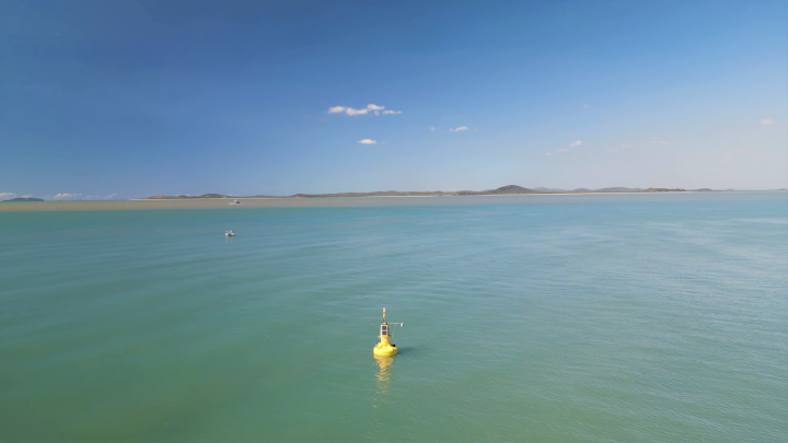
CSIRO has launched a groundbreaking project to monitor and predict water quality in the Southern Great Barrier Reef using a combination of specialised sensors and satellite data. This initiative, part of the AquaWatch Australia Mission, aims to create a world-first "weather service" for water quality, with the goal of better understanding and managing water conditions affecting this UNESCO World Heritage site.
Australia’s national science agency, CSIRO, has deployed specialised sensors on Darumbal Sea Country, located in the Southern Great Barrier Reef, to monitor sediment run-off and its impact on the marine ecosystem. The sensors are part of the AquaWatch Australia Mission, a new project designed to monitor and forecast water quality by combining sensor data with satellite information.
The Southern Great Barrier Reef is one of seven test sites for AquaWatch, which aims to revolutionise the way water quality is monitored. The reef is vital to Australia’s economy, contributing over $5.2 billion annually and supporting more than 64,000 jobs. The sensors are specifically focused on tracking sediment and dissolved organic carbon that flows from the Fitzroy River into Keppel Bay and towards the reef.
CSIRO’s AquaWatch Mission Lead, Dr. Alex Held, explained the potential of the project to improve decision-making and protect the reef: “We are testing our systems for monitoring the flow of sediment and dissolved organic carbon, which serves as an indicator of carbon exchange between land and ocean,” he said. “Excess sediment blocks sunlight, which affects marine plant life and disrupts the food supply for the region’s biodiversity.”
The project is also designed to monitor potential harmful algal blooms, which can create toxins that threaten marine ecosystems. The data from the sensors will help identify areas of concern, enabling timely interventions.
In addition to sensor data, the AquaWatch team will use advanced modelling and artificial intelligence (AI) to improve the accuracy of sediment flow predictions. Dr. Nagur Cherukuru, a senior CSIRO researcher, highlighted the role of AI in integrating data from various sources like ocean currents, wind conditions, and tidal patterns. “This allows for more accurate forecasts, which can be used by water managers to make better decisions, particularly during flood events when large amounts of sediment are washed into the ocean,” Dr. Cherukuru explained.
The AquaWatch initiative will initially provide data to research partners and Traditional Custodians. However, the long-term goal is to offer a national water quality monitoring service that could be accessed via a mobile app or integrated into existing weather forecasts, giving Australians real-time updates on water quality.
For more information, visit AquaWatch Australia Mission.
